Absorbing Rain
It’s been raining in Port Places – with novelty of rain on roof, umbrellas and raindrops on casaurinas.
Such rain as cannot be absorbed into the ground makes its way down the (Emerald) Hill to low lying Port.
This post is about the path that water takes from the top of the hill at South Melbourne Town Hall down to Crockford St in Port Melbourne.
Water has, and always will, run downhill. The area around Crockford St was, and remains, a low point at the northern tip of the Sandridge Lagoon where overland flows down Emerald Hill led to recurrent flooding, as this picture of the cable tram making its way through that intersection shows. Note the name Floodgate above the door of Ciao Bella when you pass by.

Crockford/Ingles Streets – from a copy held by the Port Melbourne Historical and Preservation Society
The City of Port Phillip with Melbourne Water have recently updated flood modelling to inform Special Building Overlays that identify areas and properties prone to overland flooding. Here is a screenshot from the interactive map which shows the way overland flows go from the South Melbourne Town Hall down to Crockford/Ingles Street in Port Melbourne – from the areas highlighted in yellow to those highlighted in green.
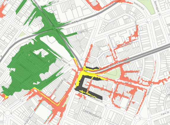
screenshot from Amendment C111 documentation source: City of Port Phillip
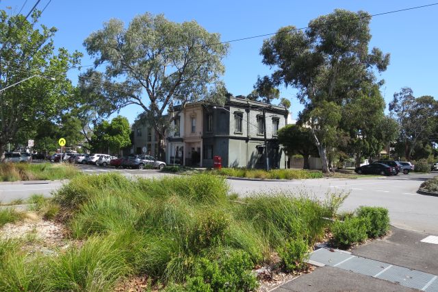
In the path of those flows, the Council has created raingardens and new planter beds combined with pedestrian crossings – slowing stormwater, slowing traffic – replacing bitumen with nature.
A meander down the hill from South to Port can now follow a network of urban wetlands and small parks.

raingarden catching leaves and absorbing the force of stormwater from up the hill – Bank St, South Melbourne
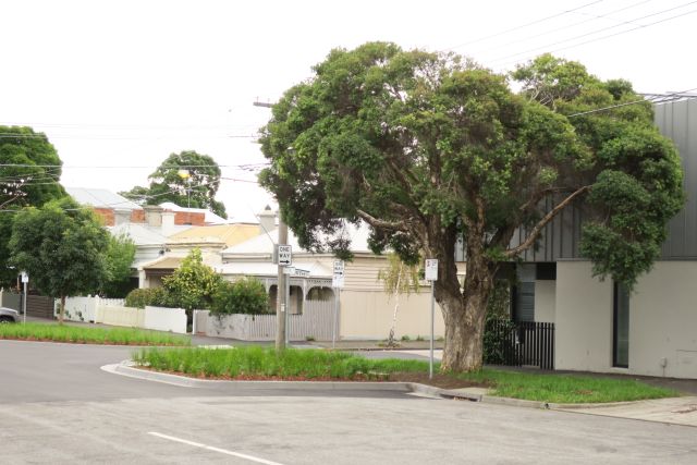
four corners of plants where road used to be – Lyell St, South Melbourne
But we can’t leave it all to the Council. Our private gardens can also play an important role in reducing urban flooding, as Alessandro Ossolo and Matthew Burns write in The Conversation this week. Replacing paved, impermeable surfaces with a variety of plants and spongy mulch not only reduces flooding but gives scope for much gardening pleasure.
Also this week, the City of Port Phillip endorsed the Port Phillip and Westernport Flood Strategy which sets a framework for the shared roles and responsibilities in managing flooding risk.
Whether you’re up or down stream your garden can add to the health of the Yarra catchment and the Bay as well as reducing flooding risk.
More
Live in Port Phillip? Explore the interactive map showing the path of overland flows. (the map takes a little while to load but well worth taking the time)
The detailed page of documentation for Amendment C111 – review of the Special Building Overlay

Leave a Reply