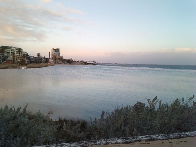
Wind and tides in Port Melbourne
The wind has dominated weather conversation this week.
Wind gusts of 113 kph were recorded at Royal Melbourne Yacht Squadron at 2.41 pm on Monday 2 September.
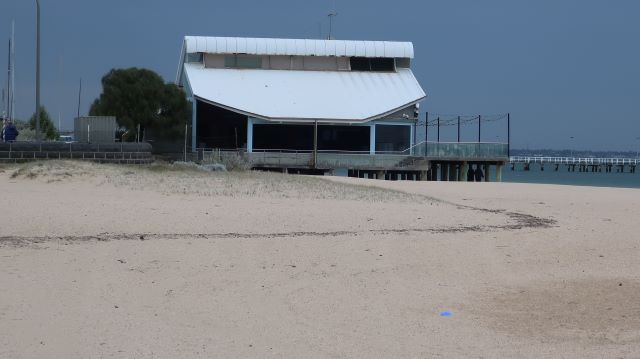
Tides were high with the sea reaching the beach wall in places. The high tide was .84m on Monday, and .88m on Wednesday and Friday.
In 1878 when Sir John Coode C.E. was invited by the Melbourne Harbour Trust to make recommendations for port improvements, the colony of Victoria had just experienced a damaging flood. His report not only addressed port improvements, but flooding concerns. The flood of 1878, while severe, was not as damaging as that of 1863.
Between 15 and 22 December 1863, storms and rain lashed the colony of Victoria. The storm was largely due to the influence of a south westerly gale banking up the tide and hindering the outflow of water from the Yarra River. The Yarra River ‘opened for itself a new mouth to the south of the Sugarworks at Sandridge’.1
In Sandridge, the winds reached near gale force, 7 on the Beaufort scale2. The barque Dunedin, which had been moored on the lee side of Town Pier, broke from her moorings and came aground on the beach. The Dunedin had just made a very satisfactory visit to Melbourne, landing stock ‘in excellent condition’ and was anticipating an equally rewarding return journey with ‘room on board for about 100 fat sheep on deck’.
That didn’t happen. Instead, the Dunedin was scrapped ‘with all her masts, yards, sails, rigging, anchors, chains &c all sold in lots’.
Sir John Coode concluded ‘I would here remark that the greater extent of flooded area in December, 1863 as compared with that of March, 1878, and the greater depth of water which accumulated over that area were caused almost entirely by the additional elevation of the sea-level at the former period’.
Coode also recommended removing the Falls (at today’s Queens Bridge). These measures eased flooding although another devastating flood occurred in 1934.
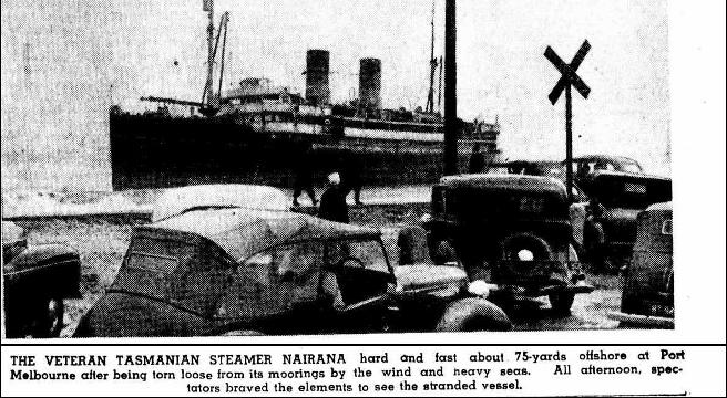
1951
On Sunday 18 February 1951, winds of 73 mph (117 kph) drove the SS Nairana aground from her mooring in Hobsons Bay. She came to rest on the beach at the end of Beacon Road. It was an ignominious end to a ship that had seen service in the First World War at Archangel and served faithfully between Tasmania and the mainland.
Seeing the high tides on Port Melbourne’s beaches this week was probably even more effective than the many signs that have invited contributions to Port Phillip Council’s Foreshore Management Plan and Coastal Adaptation Plan. The feedback from that consultation highlighted just how much people value the marine life of the Bay and concern about human impacts on it. A respondent was angry about the impact of stormwater pollution on the Bay., People were concerned about sea level rise and climate change. They were interested in resilient design and nature based solutions such as wetlands as a way of managing flooding..
In 2018, the Victorian Auditor General wrote a report on Protecting Victoria’s Coastal Assets. VAGO noted that 0.8-metre rise in sea level by 2100 will put most of our coastal infrastructure and assets at risk of inundation or erosion. It is now widely recognised that sea level rise will be much higher than .8m. VAGO found inconsistent management approaches and practices, poorly integrated planning and fragmented responsibility for coastal assets. The report recommended a state wide strategic review of coastal assets and more consistent approaches.
Since it will just not be possible to fund the repair and renewal of all coastal infrastructure, tough choices will have to be made.
A good reason to follow the next round of consultation Foreshore and Coastal Adaptation Plans.
More
1 between Port Melbourne Yacht Club and Lagoon Pier
2 Force 7 on the Beaufort wind scale is described as a near gale at 50-61 kph (32-38 mph). Whole trees in motion; inconvenience felt when walking against the wind. Foam blown in streaks across the sea
City of Port Phillip Our Coastal Future includes a useful factsheet of coastal hazard terminology including
storm surge – elevated sea level at the coast caused by the combination of low pressure and high winds associated with a severe storm.
storm tide – the total elevated sea height at the coast during a storm, which is a comination of the predicted tide height and the storm surge height.
References
Report by Sir John Coode, C.E. on Works of Improvement Melbourne Harbour Trust February 1879
A Short History of the barque Dunedin, also known as the S. W. Nash
VAGO Protecting Victoria’s coastal assets 29 March 2018

Leave a Reply