The conditions
One of the intentions of the Port Places project is to follow over time how aspirations, visions and plans for the future are expressed in planning documents, then translated by planners and decision makers into the final shapes, forms and functions of the buildings we see around the city and whether the places dreamed about materialise as intended.
Today, I explore this in a small way, prompted by explorations in the archive about the Spirit of Tasmania and the ferries that preceded it.
In the early ‘nineties, TT Lines was looking to replace the ageing Abel Tasman. The vessel purchased, the first Spirit of Tasmania, was larger. It could carry more passengers and more freight. A new marshalling yard was needed to accommodate the freight.
This coincided with a moment in time in the history of the development of the site between Port Melbourne’s piers. The Sandridge City Development Corporation’s grandiose scheme had collapsed in the financial crisis of the late 1980s. There were other pressures as well – the contamination of the site from its former use and community opposition.
The vacant, weedy site called for attention. The situation was at an impasse. A breakthrough was needed.
A forum was convened at the Port Melbourne Town Hall in August 1992 for the community to identify key themes and values they would like to see carried through into any new development. The forum resulted in a short booklet Bayside Open Planning Forum Outcomes. This document was offered to developers to inform their design response to the site.
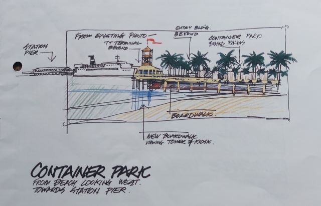
The forum considered how the design of the TT Lines freight yard could be improved and how it might work with any future plans for the Bayside site. It included these suggestions:
- the truck parking area will be 1.0 metre lower than the pier;
- a piled boardwalk at pier height, will girdle the truck park and give secure close up viewing of the ship operation; and
- the view of the trucks willl be partially screened by trees.
The suggestions were accompanied by this sketch.
Recently, amongst Perce White’s papers, I came across the planning permit issued for the freight yard, signed by Rob Maclellan, Planning Minister in the Kennett Government. The permit included the following conditions:
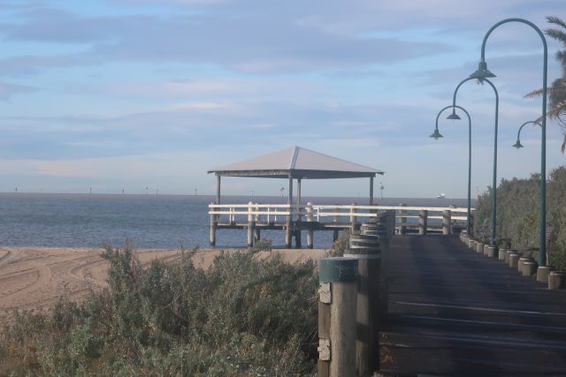
- perimeter of the truck parking area: The elevated mound shall be edged with a timber board walk for the length of the section abutting the beach and water and shall incorporate a pedestrian path connection to the existing path on Beach St
- also, a rotunda or shelter bounded on its seaward side by traditional timber railings and capping.
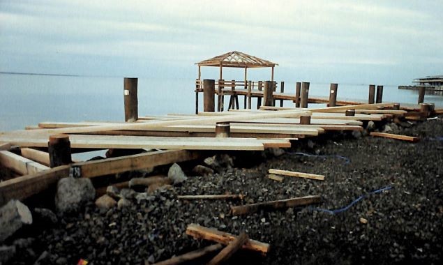
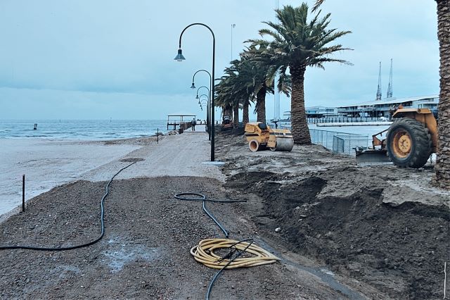
And so the rotunda and associated walkway with which we are so familiar was created in accordance with the planning permit conditions.
There is increasing interest in how planning for new developments is anticipating flooding risk from storm surge and rain.
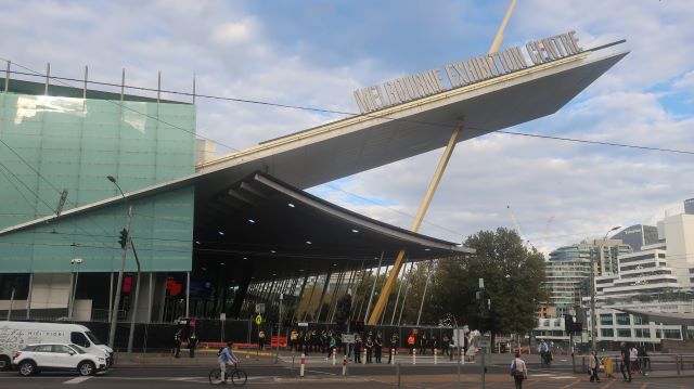
In August, the City of Melbourne considered a planning application for the Robur Tea House on Clarendon St. As you know, the Tea House is only separated from the Yarra Birrarung by the Melbourne Convention and Exhibition Centre.
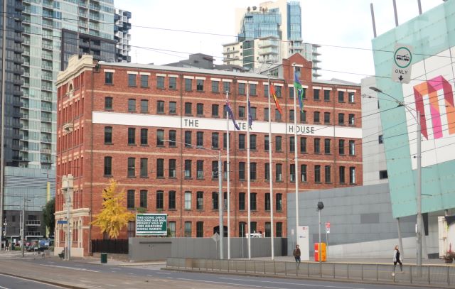
The Council supported the application but with a number of conditions.
In light of overnight flooding throughout Victoria, the conditions relating to flooding are of particular interest. They include
c) Details of how the building manager will be alerted to likely impacts on the site during a flood event. Also, the specific triggers that will inform actions by the building manager to evacuate and warn occupants.
f) A list of signage and other flood mitigation equipment that needs to be maintained and levels of maintenance required for each item.
g) Details of how occupants will be communicated with in the event evacuation isn’t achieved.
h) Detail relevant flood response activities from the City of Melbourne’s Municipal Emergency Plan Flood Sub-Plan.
i) Detail the role the building manager plays in obtaining information and how they will engage with CoM, Vic Pol and / or Vic SES to inform their actions.
j) Details with regards to flood level, depth, velocity etc and how risks associated with flash flooding events (where little to no warning is available) are to be managed.
The planning application still has to go to Heritage Victoria. The Minister for Planning will make the final decision.
The Fishermans Bend conversation hosted by Progressive Port Phillip pondered whether the vision for Fishermans Bend would be realised. Positive references were made to the community contribution to the Bayside Open Forum. Alex Felson, chair of Landscape Architecture at the University of Melbourne, spoke from his experience in working in the US about the possibilities and challenges of developing land in a floodplain. More on that another day.
Report to the Future Melbourne Committee, Planning Permit Application: TP-2021-345
28 Clarendon Street, Southbank (16 August 2022)
Leave a Reply