Sandridge
This week I walked with Year 12 geography students from Albert Park College in the Sandridge Precinct of Fishermans Bend.
Sandridge became a precinct of the Fishermans Bend urban renewal area when it was rezoned to Capital City Zone in 2012. The other Captial City zoned precincts are Montague, Lorimer and Wirraway. The Sandridge precinct is 80 ha bounded by Williamstown Rd, Graham St and the West Gate Freeway. (see map below)
Preparation for the walk led me to re-examine the aspirations and assumptions for the Sandridge Precinct in the Fishermans Bend Framework (2018) that is guiding development in Fishermans Bend.
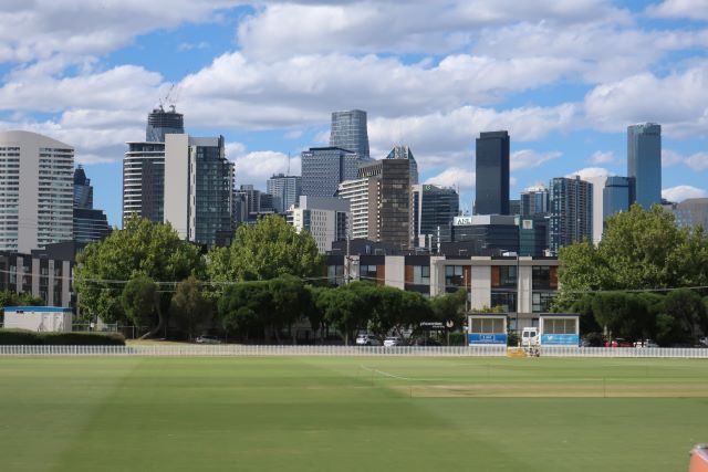
This is what the Framework says about Sandridge: ‘It will become one of Melbourne’s premium office and commercial locations, centered
around public transport connections providing excellent access to the CBD.’ And there’s more, but that’s the nub of it. We bore those fundamental assumptions in mind as we walked.
These are some of the places and themes we explored
North Port, tram stop 127 on the 109 service
once a carpark, now a gathering place
Observations and questions
- the 109 light rail, formerly a railway line, has been providing a public transport service for over 150 years
- the light rail has generous linear parks on each side. Could these provide a model for the Turner St (northern) and Plummer/Fennell St tram corridors?
- the Remembrance Garden alongside the tram stop was formerly a carpark – now it is a well used, and well loved, gathering place. It suggests how road and carparking space can be transformed.
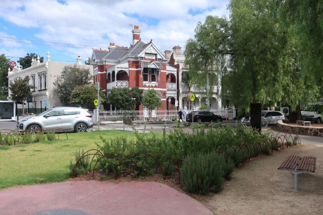
Williamstown Rd, formerly the boundary between residential and industrial Port Melbourne, now marks the boundary between residential Port Melbourne and Capital City zoned Fishermans Bend. Crossing that threshold is risky even with a pedestrian crossing.
North Port Oval (also Port Melbourne Football Ground, ETU Stadium)
North Port Oval is the precinct open space for Sandridge. The adjoining land, currently home to BAC Bikes and Bili Nursery, will in due course also become open space.
The gate was open and we stepped inside. The ground was looking immaculate.
Observations and wonderings
- will the open space be accessible – will the gate be open to the public outside game days?
- what kind of activities will be permitted on that most carefully tended turf?
- will it become the heart of the new Sandridge and wider Fishermans Bend community?
- where will people walk their dogs?
The Block (bounded by Ingles, Woodruff, Boundary and Munro Sts)
The site of the former Lever & Kitchen (Symex) soap factory includes three developments: the administrative headquarters restored by The Block, 287 townhouses and The Soap Factory by MUSK Architecture.
Observations and questions
- the repetitive nature of the town houses
- could the space have been configured differently to create more open space within the development?
- the dark lanes at the rear of the townhouses don’t feel safe
- where do the children play?
- The Soap Factory, by contrast, is various, full of interesting detail and accommodates commercial, retail and residential – a truly mixed use development.

some details from the townhouses between Ingles and Boundary Sts
222 Ingles St
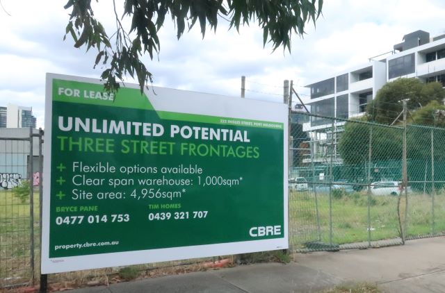
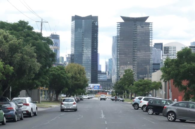
This site with 3 street frontages where fennel grows, opposite the Soap Factory development, is located in that part of Sandridge where significant height is permitted. The height is predicated on a train being provided with a station nearby in Sandridge. The height permitted is directly related to the provision of the train.
Questions
- will the assumptions of a demand for premium office accommodation hold in the post COVID period?
- how will development be shaped to accommodate the changing ways people want to work after COVID and lockdown?
Adaptive re-use of heritage buildings
“The best way to conserve a heritage building … is to use it.”
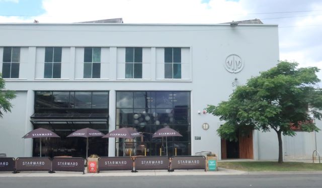
Starward Whiskey Distillery on Bertie St
Starward Whisky Distillery has created a stylish, spacious venue from the former Malcolm Moore engineering works crane shop. They’re taking advantage of the post COVID outdoor dining opportunities and the wide streets to expand onto wide Bertie street. Further down Bertie St, in a giant cul de sac created by the West Gate Freeway, Colonial Brewing Company is doing the same. Hospitality is a great transitional use of a place while the future anticipated for Sandridge is still unfolding. Punchbowl Canteen on that sunny morning was a magnet for people.
Observations and questions
- all the elements that make The Punchbowl Canteen at 1 Fennell St so attractive – the venue (of course), the shade, the trees, the older style character buildings,
- how will attractive places such as this be created in Sandridge?
Those streets!
The southern tram route along Fennell/Plummer St
The streets are wide in Fishermans Bend, between 30 and 34 m. At present, they are used almost exclusively used for vehicle traffic. The southern tram route in the Fishermans Bend Framework is proposed to cross the River and the West Gate Freeway and continue along Fennell and Plummer St.
‘The creation of the Fennell/Plummer Street civic spine will stitch the whole precinct together and provide high quality public transport, pedestrian and cycling connections into Wirraway.’
To come even close to the Fishermans Bend Framework target of 80% of trips to be made by active transport – public transport, walking and cycling – it is essential to deliver on the tram and train routes promised in the Framework.
Fishermans Bend Secondary School
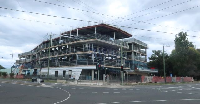
Fishermans Bend Secondary School viewed from n/w corner of Graham & Plummer St
The school is approaching completion.
Observations
- it’s very close to busy Graham St and traffic is moving at 60 kms
- riding a bike feels unsafe in this location at present
- there’s no public transport
We crossed the border into the Wirraway precinct at Graham St and entered
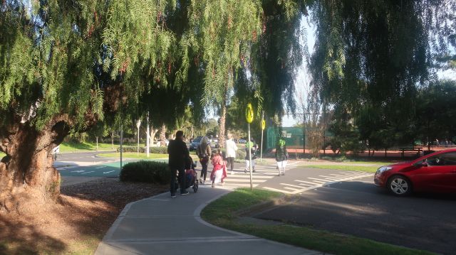
J L Murphy Reserve
Spirits soothed when we entered this large park – the designated precinct open space for Wirraway.
Observations
- it was cool and shadey
- there were pleasant places to sit
- it was away from the noise of the traffic
The curious thing is that there is no mention of ‘Sandridge’ anywhere in the Sandridge precinct just as there is no mention of ‘Wirraway’ in the Wirraway precinct. It will be interesting to see whether these names retain any relevance.
More from the vision for Sandridge
“New streets and laneways will transform the existing industrial scale blocks into a walkable neighbourhood. The creation of the Fennell/Plummer Street civic spine will stitch the whole precinct together and provide high quality public transport, pedestrian and cycling connections into Wirraway.
Architecturally diverse towers within the new commercial centre extend Melbourne’s skyline towards Port Phillip Bay. These buildings are designed to provide an attractive street level experience and protect public spaces from overshadowing.
The scale of the buildings is lower outside of this centre and transitions to low-scale developments adjacent to Port Melbourne and Garden City. A variety of new open spaces will provide a wide range of recreational activities.”
Further detail in the Fishermans Bend Framework
Where are all these places?
4 Comments
-
-
Thanks Rod. I will.
-
-
meyer
Great insights. Good to see geography students learning how good design can improve their local area.
-
Thanks Meyer. There's a lot to talk about in Sandridge!
-

Rod Giblett
Hi Janet Well done! Keep up the good work. Hope you can point interested people to my chapter on Sandridge/FB in Modern Melbourne. Rod